
Skip to discoveries

Sounds & Coast / Find your place

Manteo

Roanoke Island · Coastal habitats · Layered history

Explore this area →
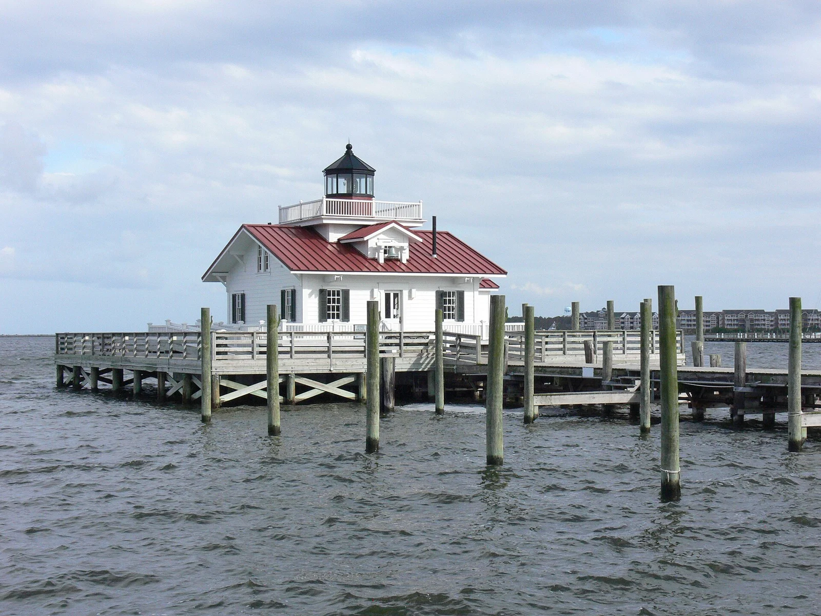
Roanoke Marshes Light in Manteo, North Carolina

A place worth knowing

Make room for Manteo.

Make Manteo a base for one thoughtfully chosen Roanoke Island outing. Aquarium exhibits and historical interpretation tell different parts of the coast’s story. Leave room for a town meal and the actual drive between sites, with coastal weather and current access shaping the day.

A few good ways to begin.

Choose a stop, then leave room for the unexpected.

North Carolina Aquarium on Roanoke Island

Explore current coastal-habitat exhibits through aquarium visitor guidance. Confirm reservations, admission and separately scheduled programs; not every animal-care area or encounter is included.

Plan this visit ↗
Fort Raleigh National Historic Site

Use National Park Service interpretation to learn about Algonquian peoples, English colonization and later community history. Check open visitor facilities and designated routes; nearby theater performances follow their own seasonal calendar.

Plan this visit ↗

Roanoke Island Festival Park

Choose current museum and interpretive offerings through state-site guidance. Confirm seasonal opening, available buildings and ship access; concerts and demonstrations require their own checks.

Plan this visit ↗

Eat & drink

Use the visitor portal to find current food and drink information around Manteo. Regional directories may cover several communities; confirm the address, opening, menus and reservations with the business.

Explore local dining ↗

Stay awhile.

Choose a base for your days around Manteo. Compare dates, location and the operator’s booking terms.

Local places to stay ↗

A little farther along.

Your next good stop.

Find a business. Put yours on the map.

Browse published places around Manteo. Business details are supplied by their owners.

Free Planner

A good plan starts here.

Plan my trip →

Your WTDO Butler

A little help along the way.

Ask Butler →
Photo credits & visitor sources

Real North Carolina photographs. Photo dates vary; images illustrate places, not current weather or operating conditions.

Independent visitor sources; inclusion is not a paid placement or an endorsement by the source.

County outlines: U.S. Census Bureau TIGERweb, North Carolina FIPS 37, all 100 counties. Simplified for display. Town markers show approximate centers, not attraction entrances or driving routes. These six WTDO areas are editorial discovery groupings, not North Carolina’s official tourism regions. Featured places are starting points, not an exhaustive inventory.

Your saved places